Lab 4: Introduction to ArcGIS Desktop & Online
2/14/22
(ArcGIS Desktop)
Map Images:
Map of the world with major rivers and population count in various shades of green (the darker the green the greater the population
Map of South Carolina with interstates in red, major rivers in blue, and married couples in various shades of purple (the darker the purple the more married couples there are in a census tract)
Map of South Carolina with interstates in red, major rivers in blue, and people aged 50-64 in various shades of tan (the darker the tan the more people aged 50-64 there are in a census tract)
ArcGIS Desktop Interesting Features:
After my interstate isolating debacle (see below-"ArcGIS Desktop Problems") I wanted to isolate something else successfully and chose to do rivers. In addition, I wanted to add another layer to my map. The rivers shapefile had every little waterway on it, from creeks to large rivers, so I just isolated the rivers. I was successful!
Some other things I discovered were:
-
You can add pictures from the local computer to the map. I covered up Australia with a green fish thing.
-
You can add text boxes to the map and change the font based on what attribute the text relates to (river name, city name, country name, highway name, etc.) and also change the font in general, such as you would do in Word.
ArcGIS Desktop Problems:
I had a problem isolating the interstates from all the highways in South Carolina. Once I finally got the code right for isolating the interstates and created a separate layer from that data I thought the layer was blank since it didn't seem to do anything. I was very confused. It turns out the color of the interstates in the separate layer of data I created blended in to the background. The interstates were very light gray which blended very well into various shades of tan. I figured this out after a while though and changed the interstates to a stand-out red.
ArcGIS Desktop Term Definitions:
Map Document (.mxd files): It is the file format that ArcMap uses to store, edit, and retrieve data. "mxd" stands for Map Exchange Document.
Table of Contents: It is the window on the left hand side of the screen and displays the Data Frame(s) and Map Layers. The properties of a Data Frame and a Map Layer can be accessed from here. You can turn certain Map Layers on and off by checking or unchecking the box next to them.
Data Frame: This holds the Map Layers and only one Data Frame can be active at a time. In addition, the Data Frame contains the map projection and coordinate system which the Map Layers use to display themselves.
Map Layer: This can be added from the Table of Contents and is added to a Data Frame. Map Layers higher up in the Data Frame are placed on top of everything else beneath it. Map Layers contain mappable data and reference a dataset (which can be viewed in the Attribute Table). These files can be layers or shapefiles.
Attribute Table: It contains the Map Layer's attribute data. It can be opened by right-clicking on the Map Layer's name in the Table of Contents and selecting "Open Attribute Table." It is a tabular representation of what data the layer or shapefile contains. It often contains an Object ID code and a shape field (which is typically "polygon"). You can select a row of data and it will be highlighted on the map.
In general, I was surprised by how different ArcGIS Desktop and Online are. Even adding layers was somewhat different!
2/16/22
(ArcGIS Online)
Comments on Exploring My Profile, My Settings, My ESRI, Training, Community and Forums, ArcGIS Blog, and Help:
-
I was unsure of what to add to my public profile (My Profile)
-
I set up the settings (My Settings and My ESRI) to be in US Standard and use Map Viewer instead of Map Viewer Classic since I used the new Map Viewer for the Do-it-Yourself Geo Apps MOOC, though I might change it back depending on where the class goes
-
I have 1000 credits
-
There are a ton of things you can subscribe to via email preferences. A lot seem interesting based on name alone
-
There are also lots of buttons, all which do different things
-
ESRI offers many training classes and for some being only 3 days they are quite expensive
-
ESRI offers exams and certifications
-
To gain access to the forums I had to promise I would be a good member
-
Finally, Help has lots of subpages and topics
Comments on my Read-through of Get Started: What is ArcGIS Online:
-
A lot of what is there is basic troubleshooting (like how to reset your password)
-
I didn't know ArcGIS (specifically Notebooks) can use Python
-
I can customize the Item Gallery. Earlier I clicked through some of the members in my organization and saw that many people had items in their Item Gallery and now I know that it is customizable
-
For creating a map the basic workflow is: choose a basemap, add layers, stylize and configure pop-ups, and save
-
When it comes to creating maps or using applications in ArcGIS Online you should know what you want from the beginning. Some of the first steps you take are the most important
-
Overall, ArcGIS has lots of applications and can do a lot
Some Interesting ESRI Trainings:
-
ArcGIS Online: The New Map Viewer (Free)
-
Creating and Sharing GIS Content Using ArcGIS Online ("requires maintenance")
-
Field Data Collection and Management Using ArcGIS ($1640)
-
ArcGIS Pro Fundamentals Learning Plan ($2460 - some courses "require maintenance" though)
-
Interestingly, there are no solely ArcMap classes because ArcGIS Pro phased it out
Speaking of ArcGIS Pro... I now have it on my computer (along with everything else it comes with).
Comments on ArcGIS Collector:
-
It can be a form of crowdsourcing if an organization/a government manages to get a hold of it
-
Unlike many other things a part of ArcGIS, it does not need an account to work
-
It's an easy way to collect data without an actual GPS
-
From the data you can make a map layer or just have the information for yourself
2/17/22 and 2/18/22
Comments on Taking the ArcGIS Online Basics Web Course:
-
There are a number of basemap options and basemaps are layers
-
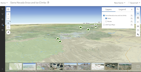
You can make 2D maps and 3D maps/scenes
-
There are many web app options (even just within "Configurable Apps") and it's important to
know that you can try out apps before settling on one through the preview feature
-
The course window was quite small and I could not collapse or shrink the side panel or progress bar
Proof in Screenshots that I Took the Course:
Halfway through Creating a web page part
3D Scene part Preview a web app part
All sections completed
Certificate


.png)
.png)
.png)
.png)
.png)
.png)